


DANIEL Voting District, Sublette County, Wyoming
About
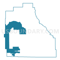
Outline

Summary
| Unique Area Identifier | 698872 |
| Name | DANIEL Voting District |
| County | Sublette County |
| State | Wyoming |
| Area (square miles) | 691.42 |
| Land Area (square miles) | 690.76 |
| Water Area (square miles) | 0.66 |
| % of Land Area | 99.90 |
| % of Water Area | 0.10 |
| Latitude of the Internal Point | 42.85340680 |
| Longtitude of the Internal Point | -110.50700340 |
Maps


Graphs
Select a template below for downloading or customizing gragh for DANIEL Voting District, Sublette County, Wyoming


Neighbors
Neighoring Voting District (by Name) Neighboring Voting District on the Map
- ALPINE Voting District, Lincoln County, WY
- BIG PINEY Voting District, Sublette County, WY
- BONDURANT Voting District, Sublette County, WY
- CORA Voting District, Sublette County, WY
- FRONTIER Voting District, Lincoln County, WY
- Marbleton North Voting District, Sublette County, WY
- PINEDALE-WEST Voting District, Sublette County, WY
Top 10 Neighboring County Subdivision (by Population) Neighboring County Subdivision on the Map
- Afton CCD, Lincoln County, WY (12,578)
- Pinedale CCD, Sublette County, WY (6,892)
- Big Piney CCD, Sublette County, WY (2,954)
- Kemmerer West CCD, Lincoln County, WY (982)
Top 10 Neighboring Place (by Population) Neighboring Place on the Map
Top 10 Neighboring Unified School District (by Population) Neighboring Unified School District on the Map
- Lincoln County School District 2, WY (13,408)
- Sublette County School District 1, WY (6,932)
- Sublette County School District 9, WY (4,119)
- Lincoln County School District 1, WY (3,894)
Top 10 Neighboring State Legislative District Lower Chamber (by Population) Neighboring State Legislative District Lower Chamber on the Map
Top 10 Neighboring State Legislative District Upper Chamber (by Population) Neighboring State Legislative District Upper Chamber on the Map
Top 10 Neighboring 111th Congressional District (by Population) Neighboring 111th Congressional District on the Map
Top 10 Neighboring Census Tract (by Population) Neighboring Census Tract on the Map
- Census Tract 9780, Lincoln County, WY (6,801)
- Census Tract 1.02, Sublette County, WY (5,926)
- Census Tract 1.01, Sublette County, WY (4,321)
Top 10 Neighboring 5-Digit ZIP Code Tabulation Area (by Population) Neighboring 5-Digit ZIP Code Tabulation Area on the Map
- 82941, WY (5,028)
- 83113, WY (3,278)
- 83128, WY (1,601)
- 83115, WY (830)
- 82925, WY (304)
- 82922, WY (257)